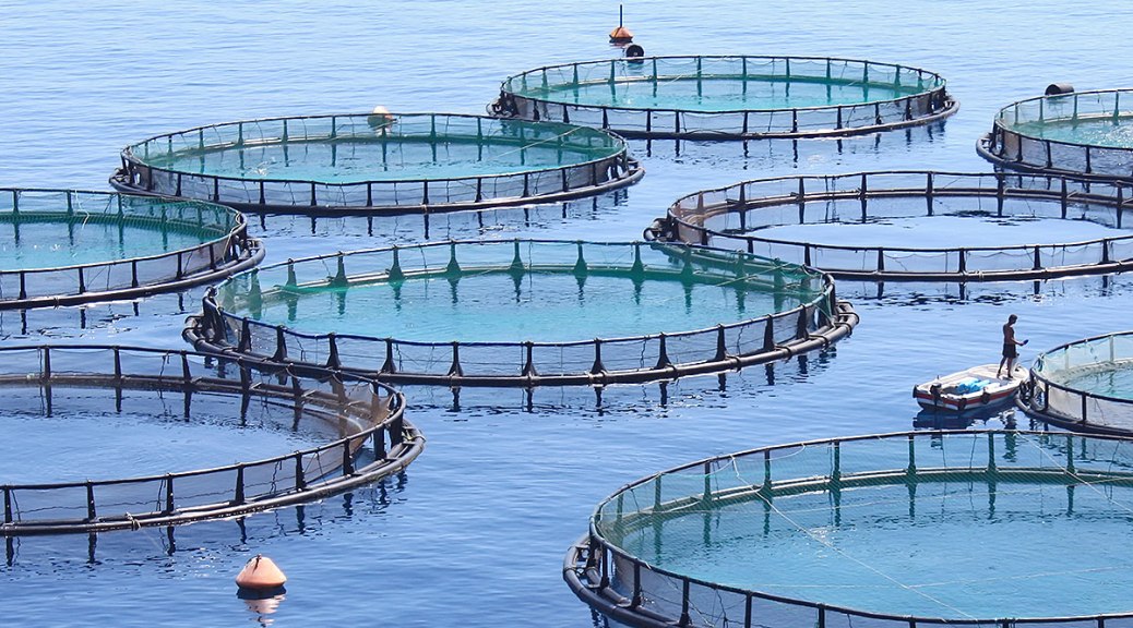
Fish farming is a sustainable means of meeting the demand for seafood. Many factors can affect the health of farmed fish, including environmental conditions, the impact of production on the local area, and harmful algal blooms.
Fish farmers often lack the necessary key environmental information about local conditions to help them become more efficient and sustainable. By developing a mobile app and web portal, the EU-funded project AQUA-USERS is supporting the growth of efficient, sustainable aquaculture production. It is providing farmers with information on the best sites to farm alongside useful on-site measurement data.
The mobile app and portal gather together satellite information and measurements, such as water quality and temperature, with on-site data input by fish farmers. These tools provide two support services: site selection and a daily management service which helps them review the decisions made. The app also sends timely reminders to warn of harmful algae blooms which can kill fish.
Before project end, the team had tested the system in three case studies in five countries – representing different European aquaculture
production systems such as mussel growth in Portugal and salmon farming in Norway – to show its commercial viability.
‘So far, no commercial AQUA-USERS services have been set up, but a number of potential users have shown interest,’ says project coordinator Marnix Laanen from Water Insight in the Netherlands. ‘In addition, at least two partners have already seen some commercial spin-offs from AQUA-USERS.’
‘So far, no commercial AQUA-USERS services have been set up, but a number of potential users have shown interest,’ says project coordinator Marnix Laanen from Water Insight in the Netherlands. ‘In addition, at least two partners have already seen some commercial spin-offs from AQUA-USERS.’
Interactive support
The mobile app allows users to interact with information in the project’s database. Up-to-date data can be retrieved along with long-term statistics. The user then enters additional measurement data in the app and is asked to record the management decision made.
In addition, data from satellites and external sources, such as wind speed and air temperature, water temperature, salinity and wave height, are also stored in the database.
The daily management service allows users to interact with data in the AQUA-USERS database. Farmers can upload new measurements and review management decisions. The measurements are compared with optimal production conditions, revealing anomalies and enabling managers to adjust their decisions and take mitigation measures.
The site-selection service has proved particularly successful. Because of strict regulations, the issuing of licences to establish new aquaculture zones is extremely complex. Thanks to improved knowledge on potential new farming sites and environmental impact assessments, governments are more likely to grant licences.
One of AQUA-USERS’ first steps was to develop guidelines on common sampling protocols and factors, such as optimal production conditions and environmental impact. This ensured that the different project partners ‘spoke the same language’, according to Laanen, and validated on-site sampling conducted by farmers where standardised measurements are required. A data policy was also established to help generate, maintain and safeguard high-quality data.
Spotted from space
The project also developed new and improved methods for detecting harmful algae blooms using Earth observation data. These blooms are one of the biggest threats to the European aquaculture industry, producing toxins which, in high concentrations, can kill fish. AQUA-USERS improved the methods for distinguishing harmful algae blooms from harmless ones in satellite images and created an archive of risk maps.
Both the AQUA-USERS site-selection and daily management tool have enjoyed commercial success since completion on the project. Consortium partners have advised clients on site selection and provided maps on harmful algae blooms. Portable water-quality scanners have also been sold.
There are plans to supply a generic, entry-level subscription for both the site selection and daily management tools which will be tailor-made. In addition, the site selection and harmful algal bloom detection tools will be refined in follow-up EU-funded projects, and a new generation of water-quality scanners will be developed.
‘For me, one of the project’s biggest achievements is the relationship we have built with aqua-users,’ says Laanen. ‘When we first spoke to industry people about things like satellite data, it was like science fiction for them. But when they realised how it could help them, they came on board and were really enthusiastic.’